|
REFINE
Browse All : maps
1-27 of 27
Work Creator (display)
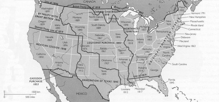
Philip Winton (active late 20th century)
Work Title (display)
Territorial growth of the United States from 1776 to 1912
Work Dates (display)
depicts period between 1776 and 1912
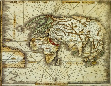
Work Creator (display)
Martin Waldseemüller (German, ca. 1470- ca. 1522)
Work Title (display)
Orbis Typus Universalis
Work Dates (display)
ca. 1507-1513
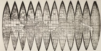
Work Creator (display)
Martin Waldseemüller (German, ca. 1470- ca. 1522)
Work Title (display)
Gores for World Globes
Work Dates (display)
sixteenth century
Work Creator (display)
Francesco Sambiasi (Italian, 1582-1649)
Work Title (display)
Kunyu Quantu (complete map of the world)
Work Dates (display)
ca. 1639
Work Creator (display)
Mark Bennett (American, born 1956)
Work Title (display)
Gilligan's Island
Work Dates (display)
ca. 1995
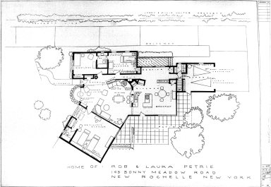
Work Creator (display)
Mark Bennett (American, born 1956)
Work Title (display)
Home of Rob and Laura Petrie
Work Dates (display)
1977
Work Creator (display)
Idrisi
Work Title (display)
Map of Egypt, from 'Atlas Geographique'
Work Dates (display)
1348
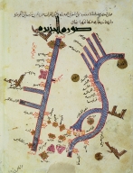
Work Creator (display)
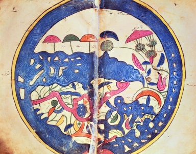
Ibrahim ibn Muhammad Istakhri (Persian, died ca. 958)
Work Title (display)
Tigris and Euphrates from a Geographical Atlas
Work Dates (display)
ca. 10th century
Work Creator (display)
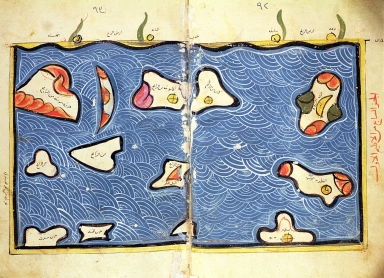
Idrisi
Work Title (display)
Indian Ocean, from an atlas
Work Dates (display)
1348
Work Creator (display)
unknown Mexican
Work Title (display)
Map of route followed by Hernando Cortes (1485-1547) during conquest of Mexico
Work Dates (display)
16th century
Work Creator (display)
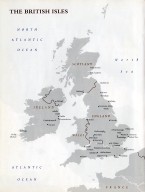
unknown (unknown cultural designation)
Work Title (display)
Map of the British Isles
Work Dates (display)
late 20th century
Work Creator (display)
unknown (unknown cultural designation)
Work Title (display)
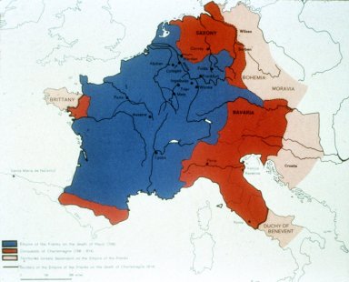
Map of Empire of the Franks on the death of Pepin (768), with conquests of Charlemagne and territories loosely dependent on Empire of the Franks
Work Creator (display)
unknown (unknown cultural designation)
Work Title (display)
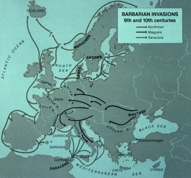
Map illustrating the Barbarian Invasions of the 9th and 10th centuries
Work Creator (display)
unknown (unknown cultural designation)
Work Title (display)
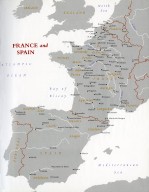
Map of France and Spain
Work Dates (display)
late 20th century
Work Creator (display)
unknown (unknown cultural designation)
Work Title (display)
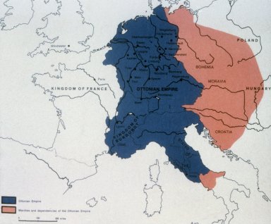
Map of the Ottonian Empire with marches and dependencies
Work Creator (display)
unknown (unknown cultural designation)
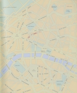
Work Title (display)
Map of Paris showing the location of Pablo Picasso's apartment at 23 rue La Boétie in the 8th arrondissement of Paris, close to the Champs-Elysées
Work Dates (display)
1918 - ca. 1932
Work Creator (display)
unknown (unknown cultural designation)
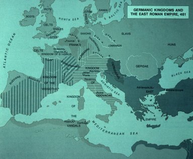
Work Title (display)
Map of the Germanic kingdoms and Eastern Roman Empire, 481
Work Creator (display)
unknown (unknown cultural designation)
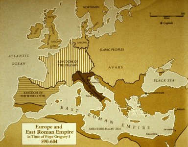
Work Title (display)
Map of Europe and the Eastern Roman Empire in the time of Pope Gregory I (590-604)
Work Creator (display)
unknown (unknown cultural designation)
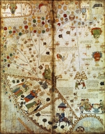
Work Title (display)
Detail from a Catalan World Map, Ms. 7249 Esp.30 Folio 2v-3
Work Dates (display)
1375
Work Creator (display)
unknown (unknown cultural designation)
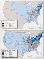
Work Title (display)
Population density in the United States in 1820 and in 1860
Work Dates (display)
1820; 1860
Work Creator (display)
unknown (unknown cultural designation)
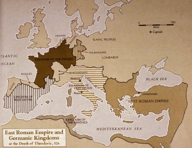
Work Title (display)
Map of East Roman Empire and Germanic Kingdoms at the death pf Theodoric, 526
Work Creator (display)
unknown (unknown cultural designation)
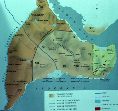
Work Title (display)
Map of Constantinople
Work Creator (display)
unknown (unknown cultural designation)
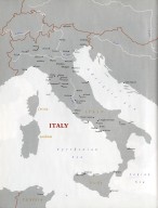
Work Title (display)
Map of Italy
Work Dates (display)
late 20th century
Work Creator (display)
unknown (unknown cultural designation)
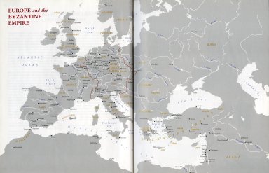
Work Title (display)
Map of Europe and the Byzantine Empire
Work Dates (display)
late 20th century
Work Creator (display)
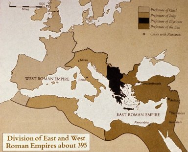
unknown (unknown cultural designation)
Work Title (display)
Map of the division of East and West Roman Empires about 395
Work Dates (display)
division of Roman Empires ca. 395
Work Creator (display)
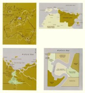
unknown (unknown cultural designation)
Work Title (display)
Maps of Arnhem Land, Australia
1-27 of 27
|